Trapani Welcome
Trapani e Provincia – hotel, agriturismo, casa-vacanze, B & B, affittacamere, campeggi
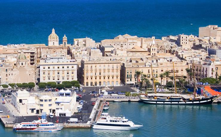
Trapani, city of many faces, a thousand flavors. City of the sea, alive and industrious. Welcome to Trapani, capital of Sicily’s westernmost province.
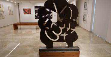
Trapani is a lively cultural center, rich in beaches, attractions, museums, ideal for a trip with friends or family. Not only faith and folklore: today Trapani combines must-see events such as the traditional “Procession of the Mysteries” on Good Friday, with social, culinary and sporting events. As you visit the city, you will realize how millennia-old traditions such as salt cultivation and coral processing coexist in Trapani in a dynamic and effervescent context.
This portal, was created precisely to get in touch with Trapani, experience it, get to know it. It will be your useful and practical travel companion. Inside you will find suggested itineraries, routes between squares and monuments, tips on local, how to get around and things to do and see.

Accomodation
Where to Sleep Categories Affittacamere Agriturismo Alcamo Alcamo Altro B&B Buseto Palizzolo Buseto Palizzolo Calatafimi Calatafimi Segesta Campobello di Mazara Campobello di Mazara Case per ferie Case Vacanza Castellamare del Golfo Castellammare del Golfo Castelvetrano Castelvetrano Custonaci Custonaci Dammusi Erice Erice Favignana Favignana Gibellina Gibellina Hotel Isole Egadi Levanzo luoghi manifestazioni Marettimo Marsala Marsala Mazara del Vallo Mazara del Vallo Misiliscemi Mozia Non Pagante Ostelli Paceco Paceco Pantelleria Pantelleria Partanna Partanna Petrosino Petrosino Poggioreale Poggioreale Residence Resort RTA Salaparuta Salaparuta Salemi Salemi San Vito Lo Capo San Vito Lo Capo Santa Ninfa Santa Ninfa Segesta Selinunte tipoturismo Trapani Trapani Valderice Valderice Villaggio turistico Vita Vita Search Popular search keys Categories No results Show all results Filter by location AllTrapaniEriceFavignanaSan Vito Lo CapoMarsalaPetrosinoMazara del ValloCustonaciBuseto PalizzoloValdericePantelleriaCastellamare del GolfoCalatafimi SegestaSalemiCastelvetranoCampobello di MazaraAlcamoGibellinaMisiliscemiPacecoPartannaPoggiorealeSalaparutaSanta NinfaVita AgriturismoCastelvetrano(Azienda agricola Latomie Torres) Agriturismo Case Sgaraglino Case VacanzaTrapani32 venti Case VacanzaCastellamare del Golfo4 Canti Case vacanze B&BCampobello di Mazara4 Stagioni B&BSan Vito Lo Capo5 Girasoli B&BSan Vito Lo Capo91zero10 B&BTrapaniA Babordo B&BSan Vito Lo CapoA CAPITANA B&BSan Vito Lo CapoA casa di … Aurora B&BMarsalaA Casa di Coso B&BTrapaniA casa di Ninni AffittacamereSan Vito Lo CapoA Cavalera B&BEriceA Draunara B&BEriceA Due Passi da Erice AffittacamereMarsalaA Giummarra B&BPacecoA Lume di Candele B&BEriceA.D.A.S AffittacamereSan Vito Lo CapoAbbadia Case VacanzaTrapaniAbita Appartamenti AgriturismoPantelleriaAbraxs vigne di pantelleria B&BValdericeAcanto B&BSan Vito Lo CapoAcasamia B & B HotelMarsalaAcos Marsala City Hotel B&BSan Vito Lo CapoAcqua Azzurra B&BSan Vito Lo CapoAcqua di Mare B&BBuseto PalizzoloAcqua di Menta B&BSan Vito Lo CapoAcquarius B&BSan Vito Lo CapoAcquaro suite rooms B&BSan Vito Lo CapoAd Hoc B&BSan Vito Lo CapoAdduari CastelvetranoHotelAdmeto B&BSan Vito Lo CapoAdriana FavignanaHotelAegusa Hotel AffittacamereSalemiAffittacamere Simone AffittacamereSan Vito Lo CapoAffittacamere Agosta AffittacamereSan Vito Lo CapoAffittacamere Ninni & Fede B&BTrapaniAfrodite B&BSan Vito Lo CapoAgreste AgriturismoCastellamare del GolfoAgricampeggio Scopello AgriturismoPantelleriaAgricola Pineda AltroCastelvetranoAgrisicilia.it AgriturismoTrapaniAgriturismo Baglio Antico AgriturismoPacecoAgriturismo Baglio Costa di Mandorla AgriturismoPacecoAgriturismo Baglio Donna Santa AgriturismoTrapaniAgriturismo Baglio Elena AgriturismoBuseto PalizzoloAgriturismo Baglio Fontana AgriturismoCastellamare del GolfoAgriturismo Baglio Pocoroba AgriturismoTrapaniAgriturismo Baglio Rindinella AgriturismoMazara del ValloAgriturismo Berlingeri Resort AgriturismoEriceAgriturismo Borgo di Pietrabianca
Leggi tutto
See & Do
See & Do
Leggi tutto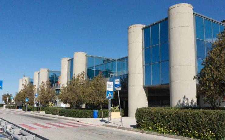
Getting here
Getting to Trapani, Marsala and Birgi Airport All means of transportation connecting Trapani This page will list all the information needed to reach Trapani either by plane, by train, and also by ship and by bus and hydrofoil. Click on the tabs below for information Plane Bus Car Transfer Ship Railways Plane Flights, planes and airport in Trapani Vincenzo Florio Airport ( Trapani – Birgi ) about 15 km from both the city of Trapani and the city of Marsala – www.airgest.it +39 0923 842502 AIRLINES TEL: 899.018.880 www.ryanair.com
HjemmesidePANTELLERIA AIRPORT Information www.pantelleriairport.it tel: +39 0923 911398 Car rental: present at the arrival stand at Pantelleria airport. Connection to the city of Pantelleria by public transportation PALERMO FALCONE BORSELLINO AIRPORT Information Distances: 34 km from the city of Palermo (central station) and 86 km from the city of Trapani www.gesap.it Contacts: Toll free number 800-541880 – Custumer Service +39 091-7020718 – Switchboard +39 091-7020111 Car rental: present at Palermo airport arrival booth Connection with the city of Palermo: Shuttle with Segesta Company www.segesta.it Train : Airport – Palermo Call center: 892-021 Ticket office: 199 166 177 Airport ticket office: +39 091 7044007 www.trenitalia.it Bus Buses to and from Trapani Trapani is connected by several companies that provide bus transportation. The main ones are: Sicilian Transport Company Tel: 0916208111 Links the entire province of Trapani, but also the entire region through exchanges SEE SCHEDULES ON THE OFFICIAL AST WEBSITE Autoservizi Salemi Phone: 0923 981120 www.autoservizisalemi.it Links Trapani Birgi Airport – Palermo city Trapani Birgi Airport – Marsala Marsala – Palermo city Marsala – Selinunte Marsala – Mazara – Salemi – Campobello di Mazara – Castelvetrano Marsala – Salerno – Naples – Rome – Milan CHECK THE SCHEDULE ON THE OFFICIAL WEBSITE OF AUTOSERVIZI SALEMI Segesta Airlines Tel: 091 304090 Links Palermo Palermo Airport Catania Rome CHECK OUT THE SCHEDULE ON THE OFFICIAL SEGESTA WEBSITE Autolinee Lumia Tel: 0922 20414 Links Trapani Birgi Airport – Sciacca – Porto Empodocle – Agrigento Trapani city – Sciacca – Porto Empodocle – Agrigento Marsala – Sciacca – Porto Empodocle – Agrigento CHECK OUT THE SCHEDULE ON THE OFFICIAL SEGESTA WEBSITE Car Roads and highways to reach Trapani The suburban roads connecting Trapani consist of the A29 highway and other state and provincial roads connecting it to adjacent municipalities Here is the detail of suburban roads: The A 29 highway that connects Trapani with Palermo and the inland areas of the province S.S. 187 stands as a closer alternative to the coast to State Road 113 Settentrionale Sicula, whose route runs more inland. The route, which runs essentially along the west-east axis, passes through the towns of Valderice, Buseto Palizzolo and touches the southern slopes of Mount Sparagio. It then arrives at Castellammare del Golfo, after which it assumes the role of coastal road, skirting the Palermo-Trapani railway line. It then passes through the towns of Alcamo Marina, Balestrate and Trappeto, finally joining State Highway 113 Settentrionale Sicula. S.S. 113 that runs along the northern coast of Sicily, going from Messina to Trapani, passing through Palermo. S.S. 115 linking the cities of Trapani and Syracuse via Agrigento, Gela, and Ragusa. The road crosses the five provinces of the Mediterranean coast of Sicily-Trapani, Agrigento, Caltanissetta, Ragusa, and Syracuse-and is part of the European routes E931 from Castelvetrano to Gela and E45 from Gela to Rosolini. The length of the road is about 383 kilometers, thus being the longest on the island. However, the official mileage is 409 kilometers as it is based on the longest original route. It is divided into two sections (Trapani to Porto Empedocle and Agrigento to Syracuse) and a branch (Modica to Ragusa). Provincial roads connected with Trapani S.P. 20 Trapani – Bonagia – Valderice: from the built-up area of Trapani to the built-up area of Valderice S.P. 21 Trapani – Ragattisi – Marsala and branch road Bosco Pecorume: from the town of Trapani to the town of Marsala and branch road Strada statale 115 Sud Occidentale Sicula S.P. 29 Trapani – Salemi: from the town of Trapani to State Road 188 Centro Occidentale Sicula S.P. 31 Trapani – Martogna – Erice: from the town of Trapani to the Regional Road Immacolatella – Erice S.P. 77 Litoranea di Trapani: from the town of Trapani to SP20 S.P. 83 Trapani ring road: from State Road 187 in Castellammare del Golfo to State Road 113 Settentrionale Sicula toward Xitta Transfer Trapani Tourism Service info@trapanitourismservice.com – Trapani Tel. +39 328 8009095 – Fax. – Quick, convenient and economical service for transfers to/from the Sicilian airports of Trapani and Palermo. Transfers on request from Trapani to major locations in Sicily Exclusive Transfer Via dell’Angelo, 2 – Trapani Tel. +39 347 3816877 – Fax. – Tourist transfer services and more for travelers in the province of Trapani Ship SHIP/FERRY CONNECTIONS Egadi Islands-Trapani Siremar https://carontetourist.it/ Liberty Lines
HomepagePantelleria-Trapani Siremar https://carontetourist.it/ Liberty Lines
HomepageIslands Ferries www.traghettidelleisole.it FROM THE PORT OF PALERMO Napoli-Palermo and Cagliari-Palermo Tirrenia – www.tirrenia.it Genoa-Palermo, Naples-Palermo, Tunis-Palermo, Civitavecchia-Palermo. Grandi Navi Veloci www.gnv.it Salerno-Palermo and Tunis-Palermo Grimaldi Ferries www.grimaldi-ferries.com Railways Reaching Trapani by train, is definitely the least popular mode as well as the least fast. But if you prefer the train to other means of transportation , check out the official timetables from the TRENITALIA website Plane Flights, planes and airport in Trapani Vincenzo Florio Airport ( Trapani – Birgi ) about 15 km from both the city of Trapani and the city of Marsala – www.airgest.it +39 0923 842502 AIRLINES TEL: 899.018.880 www.ryanair.com
HjemmesidePANTELLERIA AIRPORT Information www.pantelleriairport.it tel: +39 0923 911398 Car rental: present at the arrival stand at Pantelleria airport. Connection to the city of Pantelleria by public transportation PALERMO FALCONE BORSELLINO AIRPORT Information Distances: 34 km from the city of Palermo (central station) and 86 km from the city of Trapani www.gesap.it Contacts: Toll free number 800-541880 – Custumer Service +39 091-7020718 – Switchboard +39 091-7020111 Car rental: present at Palermo airport arrival booth Connection with the city of Palermo: Shuttle with Segesta Company www.segesta.it Train : Airport – Palermo Call center: 892-021 Ticket office: 199 166 177 Airport ticket office: +39 091 7044007 www.trenitalia.it Bus Buses to and from Trapani Trapani is connected by several companies that provide bus transportation. The main ones are: Sicilian Transport Company Tel: 0916208111 Links the entire province of Trapani, but also the entire region through exchanges SEE SCHEDULES ON THE OFFICIAL AST WEBSITE Autoservizi Salemi Phone: 0923 981120 www.autoservizisalemi.it Links Trapani Birgi Airport – Palermo city Trapani Birgi Airport – Marsala Marsala – Palermo city Marsala – Selinunte Marsala – Mazara – Salemi – Campobello di Mazara – Castelvetrano Marsala – Salerno – Naples – Rome – Milan CHECK THE SCHEDULE ON THE OFFICIAL WEBSITE OF AUTOSERVIZI SALEMI Segesta Airlines Tel: 091 304090 Links Palermo Palermo Airport Catania Rome CHECK OUT THE SCHEDULE ON SEGESTA’S OFFICIAL WEBSITE Autolinee Lumia Tel: 0922 20414 Links Trapani Birgi Airport – Sciacca – Porto Empodocle – Agrigento Trapani city – Sciacca – Porto Empodocle – Agrigento Marsala – Sciacca – Porto Empodocle – Agrigento CHECK OUT THE SCHEDULE ON SEGESTA’S OFFICIAL WEBSITE Car Roads and highways to reach Trapani The suburban roads connecting Trapani consist of the A29 highway and other state and provincial roads connecting it to adjacent municipalities Here is the detail of suburban roads: The A 29 highway that connects Trapani with Palermo and the inland areas of the province S.S. 187 stands as a closer alternative to the coast to State Road 113 Settentrionale Sicula, whose route runs more inland. The route, which runs essentially along the west-east axis, passes through the towns of Valderice, Buseto Palizzolo and touches the southern slopes of Mount Sparagio. It then arrives at Castellammare del Golfo, after which it assumes the role of coastal road, skirting the Palermo-Trapani railway line. It then passes through the towns of Alcamo Marina, Balestrate and Trappeto, finally joining State Road 113 Settentrionale Sicula. S.S. 113 that runs along the northern coast of Sicily, going from Messina to Trapani, passing through Palermo. S.S. 115 linking the cities of Trapani and Syracuse via Agrigento, Gela, and Ragusa. The road crosses the five provinces of the Mediterranean coast of Sicily-Trapani, Agrigento, Caltanissetta, Ragusa, and Syracuse-and is part of the European routes E931 from Castelvetrano to Gela and E45 from Gela to Rosolini. The length of the road is about 383 kilometers, thus being the longest on the island. However, the official mileage is 409 kilometers as it is based on the longest original route. It is divided into two sections (Trapani to Porto Empedocle and Agrigento to Syracuse) and a branch (Modica to Ragusa). Provincial roads connected with Trapani S.P. 20 Trapani – Bonagia – Valderice: from the built-up area of Trapani to the built-up area of Valderice S.P. 21 Trapani – Ragattisi – Marsala and branch road Bosco Pecorume: from the town of Trapani to the town of Marsala and branch road Strada statale 115 Sud Occidentale Sicula S.P. 29 Trapani – Salemi: from the town of Trapani to State Road 188 Centro Occidentale Sicula S.P. 31 Trapani – Martogna – Erice: from the town of Trapani to the Regional Road Immacolatella – Erice S.P. 77 Litoranea di Trapani: from the town of Trapani to SP20 S.P. 83 Circonvallazione di Trapani: from State Road 187 in Castellammare del Golfo to State Road 113 Settentrionale Sicula toward Xitta Ship SHIP/FERRY CONNECTIONS Egadi Islands-Trapani Siremar https://carontetourist.it/ Liberty Lines
HomepagePantelleria-Trapani Siremar https://carontetourist.it/ Liberty Lines
HomepageIslands Ferries www.traghettidelleisole.it FROM THE PORT OF PALERMO Napoli-Palermo and Cagliari-Palermo Tirrenia – www.tirrenia.it Genoa-Palermo, Naples-Palermo, Tunis-Palermo, Civitavecchia-Palermo. Grandi Navi Veloci www.gnv.it Salerno-Palermo and Tunis-Palermo Grimaldi Ferries www.grimaldi-ferries.com Train Reaching Trapani by train, is definitely the least popular mode as well as the least fast. But if you prefer the train to other means of transportation , check out the official timetables from the TRENITALIA websiteLeggi tutto